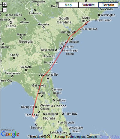
I was honored to be invited to the wedding of Jeff Robins, my nephew, and Victoria Mecleary, just a little bit north of Philadelphia, PA. I chose to fly into Wings Field in Blue Bell, PA, which was only a few miles away from the hub of activity for the weekend. I captured some of the wedding activities on video. Below the video are some notes on the flights.
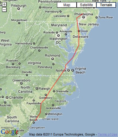
The flight north was pretty much uneventful. My time in the air for both legs was about 6 hours 10 minutes, with generally favorable winds. I stopped for gas at North Myrtle Beach - Grand Strand airport, where the service was good. I did divert around a storm cloud near Fayetteville, NC, as you can see in the second picture below. There were a lot of clouds, so I didn't get a good view of world below me, but I did get up there on time.
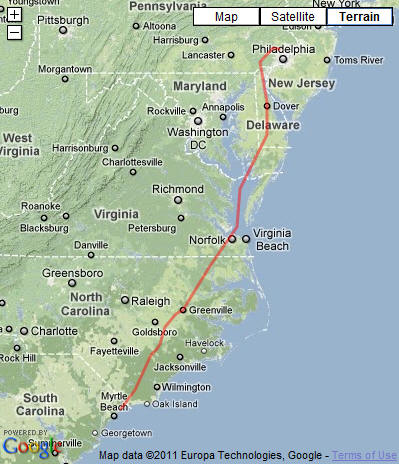
The return trip looked to be a little more of a challenge because of weather for the departure. The forecast was for fog until about 11:00 AM, so I filed a plan that had me taking off at 12:00 noon. At the airport, I learned that the only way to request the IFR clearance was by telephone, so I did the preflight checks and all the other stuff, and just when I would normally start the engine, I called for the clearance. Next was the engine start and taxi to the runway, and finally the "before take-off" checks. I was ready to go, so I called the magic phone number again for a "release", and then got airborne. After takeoff, I entered the bottom of the clouds at about 900 feet; my clearance included a climb to 2000 feet and a turn toward Pottstown, which I did, in the clouds. Before going far, I was given a turn toward the south to Modena, and a continued climb to 5000 feet. (Both Pottstown and Modena are radio navigation beacons that help pilots know where they are when they can't see the ground.) I was told to continue climbing to 8000 feet, my cruising altitude, and, after passing Modena, turned more south toward Dover, DE. During the climb, I broke out of the ground clouds around 6000 feet and was flying between the layers for the next couple of hours. Being between layers means that there are clouds below and clouds above, but the immediate air that I was in had not formed a cloud; so I could see in front where I was going, but I couldn't see the sky or the ground. I pressed on, following the flight plan that I had filed, and staying away from the DC restricted airspace.
Winds were not nearly as favorable as on the trip north, where they were generally pushing me. Today the winds were coming from ahead and were slowing me down. As I passed through Maryland on the DelMarVa peninsula, my speed through the air was 145 knots, but the air mass was moving in the opposite direction at about 25 knots, so my ground speed was reduced to 120 knots. I turned the cabin heater on for a while because the outside air temperature was around 50 degrees F (or 10 C).
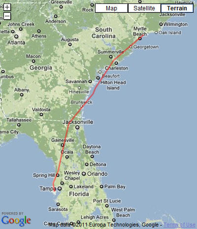
The undercast (clouds below) started to break up as I crossed the Chesapeake Bay, while I was listening to a Bruce Springsteen concert replay on XM radio. The clouds were ascending, so I was in and out of clouds for the rest of the leg to North Myrtle Beach - Grand Strand airport for a gas stop.
The leg from Grand Strand to St Pete was mostly above a cloud layer, so I again could not see the ground, but I now had a good "horizon" to keep things stable. I touched down at St Pete after about 6 hours 54 minutes, or almost an hour more than the trip north, but with having had a great weekend, and seeing several people that I had not seen in years.
I put over 14 hours in my logbook for the trip, landed at two new airports, and got some actual instrument time. All in all, a good trip.